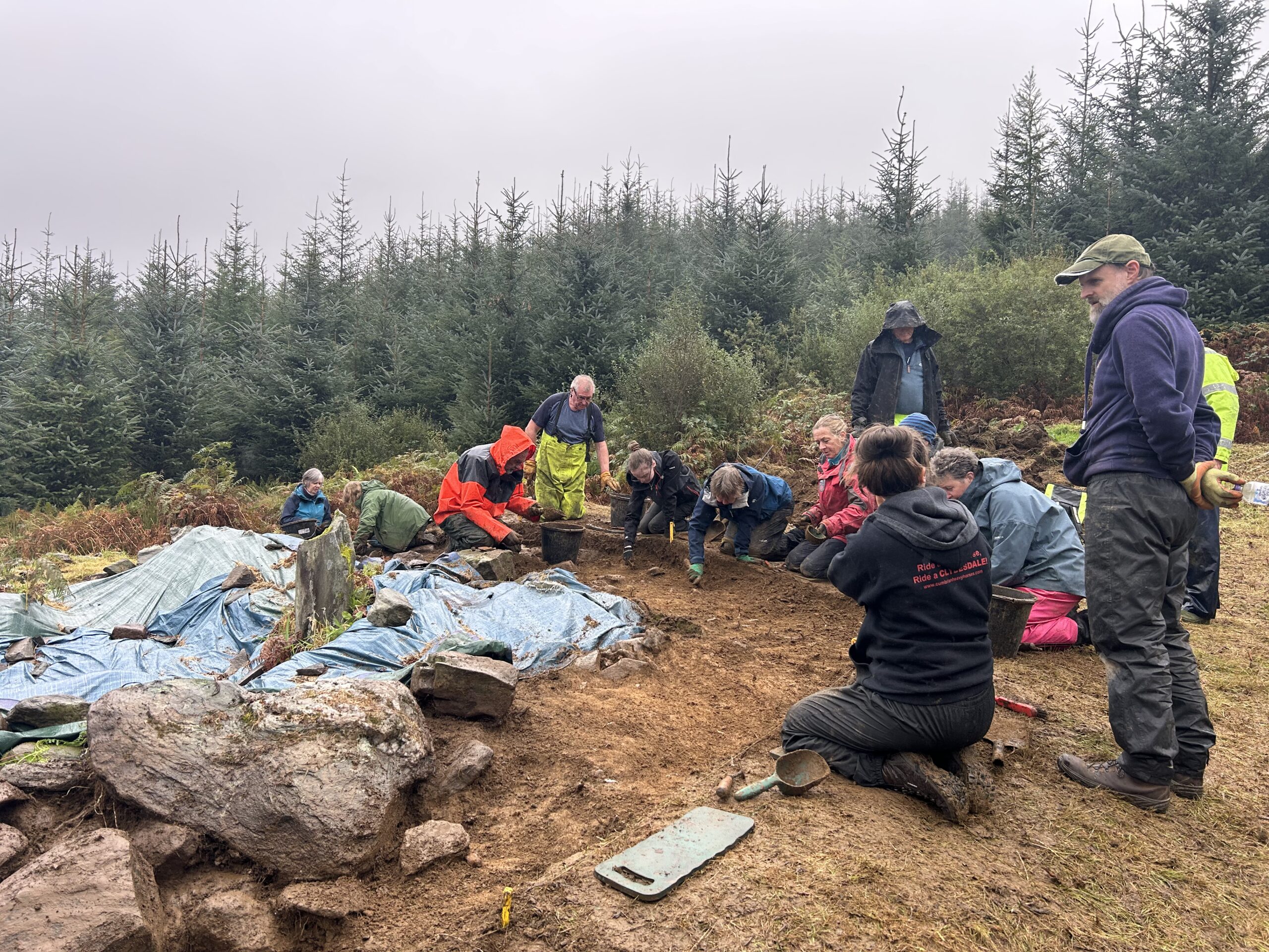
Image -The 2025 excavation at Creag Liath, as part of an ongoing Adopt-a-Monument project with the community group
“Every single time I’ve been down this road it’s been raining” says Andy as we crawl down the one-way traffic of the ‘Rest and Be Thankful’ pass of the A83. The cloud is sitting low around us and I wonder if the peaks it is hiding are of hills or mountains. Now heading into Autumn, rich oranges and deep greens colour the landscape, insistent on still being seen through the rain. One of our project officers at Archaeology Scotland and a familiar face to many of our community groups, Andy has a lot of experience travelling this route when working on an Adopt-a-Monument project in Glendaruel. The site is called Creag Liath, or the Grey Stones, and was first visible to the local community as a large area of stones and circular depressions within a clearing in Stronafian Community Forest. Adopt-a-Monument have been working with the community group here since 2022, after the mysterious collection of stones were found by the Friends of Stronafian Community Forest. Each season of excavation has exposed more of the stones at the site, and gained new clues as to the character of the remains here.
While I’d seen pictures before, the scale of Creag Liath has to be seen in person to fully be appreciated. The site is made up of low mounds and depressions, covering an area of about 50m squared on a gentle slope.
Debbie Kirby, who heads up the volunteer group, described their first encounter with the site. “We saw the upright stone peeking through the top of the bracken…And then fighting through the brambles to stand at that spot, you could make out what looked like six circular structures.” The excavations revealed these cell-like features, one of which also contained that upright stone and a small fragment of prehistoric pottery. The mystery of the site really hooks you in, and everyone is keen to keep exposing more of the site in the hope it answers some of our questions.
Debbie in particular is keen to get some answers, “What are the structures? And does the fact that we aren’t finding much mean something? Is it a ritual structure or somebody’s dwelling?” she speculates as we discuss the site. She acknowledges that a big driving factor in the whole project is her personal interest and “nosiness” as she calls it.
As the person writing funding applications, organising everyone to the right place at the right time, and keeping an eye on the site between excavations, she is an invaluable member of the team. I ask Debbie about how she first became interested in archaeology. She tells me how from a young age she has been keen to travel and find out more about new places and people. She remembers a lane behind her grandmother’s house, “it had these really high banks, and I remember wondering how they got to be that high. There’s an old convent up there and I’d peer over the wall and wonder what the buildings were all about.” A keen sailor, her trips with her husband Gary are also governed by this curiosity. “We always go to a place that interests us…just drop anchor and explore it”. The enthusiasm for exploring, learning and sharing stories seems to be a unifying factor for the group. Everyone who had dug here before is very knowledgeable about the site, keen to share photos of previous seasons and, of course, to get on with the archaeological work and find some answers to their questions.
In the middle of the week we do, however, drag ourselves away from our buckets and trowels to take a walk around the other sites on our doorstep here. The site sits within a rich prehistoric landscape, with a range of evidence for Neolithic activity within the forest area. A short walk away from Creag Liath is the site of Auchategan, a multi-phase site which comprises evidence for occupation from the Neolithic to the medieval period. The site was originally excavated between 1967 and 1970, by Dorothy Marshall who set out to find the site of St Modan’s chapel. Instead, Marshall identified two Neolithic phases of occupation, the evidence of which was partially destroyed with the construction of a Bronze Age cairn directly on top of the Neolithic site.
The remains of two hut circles were identified for the earlier Neolithic phase, while the second was characterised by the construction of a series of stone hearths. A flint knife was found in one of these hearths, while another contained an ashy deposit that included a greenstone axehead, lithics made from pitchstone and half a lignite bead. A radiocarbon date taken from charcoal from either Hearth 17 or 18 of the second Neolithic phase, produced a date of 3325-2496 cal BC (I-4705, 95.4% probability, OxCal v4.4). Recently the community group received funding for a radiocarbon date of some charred residue on a Neolithic carinated pot which returned a date of 3766-3534 cal BC, potentially providing a date for the earlier Neolithic phase. One of the volunteers with us today is Duncan, who works as a vet on the Isle of Bute, but as a teenager took part in the excavations with Dorothy Marshall. This is his first visit to the site since the 1968 excavation, and he happily shares his memories of the dig with us. He paints a picture of a formidable but generous woman, as Duncan describes how when Dorothy Marshall offered you “advice” you made sure to take it!
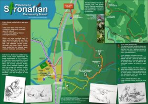
Map of Stronafian Community Forest, showing the locations of the cup and ring marked stone, Auchategan and Lephinkill Chambered Cairn (Copyright Friends of Stronafian Community Forest)
From Auchategan, we walk down towards the road, crossing streams and negotiating mud and brambles, to reach a small patch of woodland surrounding a cup and ring marked stone. These symbols are difficult to date, but were likely made during the late Neolithic or Early Bronze Age. The symbols are abstract, circular cup marks of combinations of these hollows with circular rings, or key holes shaped rings surrounding them. There are many different theories to what these symbols might mean. Were they a form of map perhaps helping to guide people through the landscape? Were the markings intended to catch water or dyes? Did these shapes have ritual significance? We spend at least half an hour stood around the rock art panel, identifying the shapes carved into the stone surface and discussing someone may have chosen this surface, place and combination of symbols. The great thing about these conversations for me is that no one is ever right or wrong and everyone loves to bounce ideas around!
After heading back up to Auchategan for lunch, we walk on to the very top of the hill. Here, sitting on a terrace with views across the Clachan of Glendaruel, is Lephinkill, a Neolithic chambered cairn. This site too was initially mistaken for an early Chapel, and this is how it was recorded on the 1965 OS map. Today, the site is mostly covered with grass and heather, but with some stone still visible. Lephinkill was recorded by Audrey Henshall as ARG16. She notes that the mound was clearly visible, standing around 6ft high at its tallest point, and aligns almost exactly north to south. Some of the community group have been here before, but it is the first visit for Andy and I. Our first reaction is a genuine “Wow”.
I’d expected a handful of stones visible amongst a mass of vegetation but instead we were met with an impressive steep-sided mound still well over a metre high most of the way across. Perhaps it’s location at the top of the hill has protected it from damage in the millennia since it’s construction, with fewer people looking to this pile of stone for construction material or as an obstruction to using this land for farming. The cairn has also not been disturbed by previous excavation, although Marshall notes that a leaf-shaped flint arrowhead was found near the cairn, and was similar to two found at Auchategan. Another cairn, Ardachearanbeg (ARG15) is located less than a kilometre away as the crow flies, but too far in real-world walking time to reach today. While we walk through this landscape, it is clear how well cared for the heritage here is. Signs and information boards have been researched, designed and put up by the local community, with reconstructions imagined and beautifully drawn by Debbie’s husband Gary. The drawing of Lephinkill allows us to directly compare what we see on the ground, the technical plan created by Henshall and an artist’s interpretation of what the site may have looked like in the Neolithic.
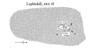
Plan of Lephinkill chambered cairn (Henshall 1972, 329)
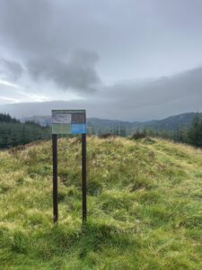
Lephinkill chambered cairn viewed from the south
At the end of the day, Debbie and I hide out in her car to avoid the hammering rain, and discuss the history of work in the area and how it impacts her experience of her local heritage, and the work she is conducting across Stronafian Forest. “Dorothy Marshall I think was quite incredible” says Debbie, in reference to her lifelong dedication to archaeology in Argyll and Bute. Having discussed Marshall’s excavations earlier in the day we talk about how she returned year after year to Auchategan, much like Debbie and her group are now doing at Creag Liath, and muse over what brings you back time and time again. Is it obligation to finish a job? Is it a love of the place and it’s people? Is it the unanswered questions and the curiosity that keeps a hold on you? Or is it a combination of all these factors? We also discuss Betty Rennie, who Debbie has a huge appreciation for her “amazing” contribution to the archaeology of the local area.
Rennie was also a woman undertaking archaeological work in her spare time, with some of her more prolific publishing years coming in her retirement. This dedication to compiling records of sites during evenings, weekends and holidays was also true for Audrey Henshall. It is this kind of practice, and that tired to a local patch, landscapes that you learn and are invested in, that is perhaps more relatable to community archaeologists than the achievements of academics in university roles, and the examples set by Henshall and Rennie show how they are active participants in the stories of these landscapes, rather than observers of the stories told by others.
I also spoke to Katie Halavage, a graduate of Glasgow University, who previously dug on the Drumadoon cursus on the Isle of Arran, the Big Dig at Newbattle Abbey College and a previous season at Creag Liath. She first came to the site at the start of her fourth year of university, and she described how the experience of working on a small community dig was beneficial to her studies, as it gave her the opportunity to develop her skills and add to the records produced for the site. When asked what keeps her coming back, Katie said “I just thoroughly enjoy it…the people you meet…the sense of community. And I do enjoy being outside, I worked with horses when I was younger, so that’s just where I’m in my element…It’s definitely something I will keep doing, while I can get on my hands and knees anyway!”. This dedication from the volunteers hasn’t gone unnoticed. “Nobody’s really faded out” noted Debbie when we discussed the last few years, “We’ve got more people interested and they’ve held onto their interest and keep coming back to find out more”. There is something special about a group brought together by a shared curiosity, and perhaps a shared appreciation for their fellow volunteers’ baking too.
Friday is our final day in Glendaruel for this season, and as Storm Amy begins to whip up the wind and some ominous grey clouds, we scramble for some final recording before packing up and racing the weather across to the east. We are diverted down onto the military road at the Rest and Be Thankful. It surprises neither of us that it is, once again, raining.
Supported by the Society of Antiquaries of Scotland’s Audrey Henshall Legacy Award.