
First footsteps?
Walking out onto Rannoch Moor today one could be forgiven for imagining themselves among the first humans to venture into a post-glacial world. This vast apparently empty landscape stretches out for over approximately 50 square miles, from Loch Rannoch in the East to Corrie Ba, Glencoe, Glen Etive and Glen Orchy in the West. Once you step away from the roar of the A82, or the growling shunt of the occasional train on the West Highland Line, there is little evidence for human activity to be seen – apart from by the keenest eye.

A track out onto Rannoch Moor to the West of the A82 at the River Ba. Photo © Dr Cole Juckette)
This is a landscape of flow and flux.
During the last glacial period, the Loch Lomond Stadial or the Younger Dryas, a vast ice cap lay above this vast basin and from it glaciers flowed outwards forming the radial glens which emerge from the Moor of Rannoch today. These vast rivers of ice cut steep glens through the hard volcanic rock of the Lochaber hills as they flowed out from the moor. As the ice melted it left behind a landscape shaped by the material within these flows, vast glacial erratic boulders, eskers and drumlins and winding lateral and terminal moraines form the fingerprint of this landscape. A vast network of basins and ridges emerged from the retreating ice, quickly infilled by meltwater and rain. Ribbon lochs, kettle holes and a patchwork of lochans emerged. Within some of these, over thousands of years, peat began to develop until around the Bronze Age blanket bog covered much of the landscape. As you walk across this landscape today the ground shivers beneath your feet, mobile and in flux. Gulleys eroding from the peat expose the bleached trunks of historic pines which died as the landscape grew wetter thousands of years ago. Bone white, these are somewhat haunting reminders of how past communities within this landscape have had to adapt, living in a changing world.
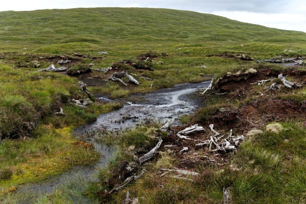
Bleached stumps of bog pine trunks eroding from the peat of the moor. Photo ©Dr Cole Juckette
Local folklore states that this vast landscape of roaring rivers and churning peat, drumlin mound and lochan was formed by warring giants. One with an insatiable hunger desired to eat the whole of the earth, the other with unquenchable thirst wished to drink all the waters of the world. They met on this vast moor in the heart of Scotland’s Highlands and their battle carved out these glens, thrust erratic bounders across the landscape, and gouged out deep lochs, their bones eventually forming the vast drumlins and eskers which give this landscape an almost alien terrain – like a mossy surface of the moon.

A lochan in Rannoch Moor West of the A82 with Corrie Ba in the background. Photo © Dr Cole Juckette
While walking along one of the tracks out into the heart of the Moor from the A82, following the contours of a drumlin mound, my foot caught on a wayward thrust of quartzite on the path. I peered down in irritation and from the corner of my eye an unusual slither of stone caught my gaze. I reached down and plucked from the gravel of the track a small piece of flint. On visits to this site since myself and colleagues have found three more flints, then another two. These flints vary from a milky white-grey to an opaque treacle-brown.

Four of the microliths recovered from along a track on Rannoch Moor, a further two flints have been found since on field surveys on the moor. Photo © Aris Palyvos
These flints are microliths, the remains of tools crafted by Mesolithic communities who forayed into these uplands perhaps 11,000 years ago to hunt reindeer in the summer months and gather berries, tubers and other upland plants. Some of these flints may have been used as blades on a harpoon or spear, or as specialist tools for butchering carcasses, preparing hides, or processing textiles. Similar upland Mesolithic sites have been identified in the headwaters of the Tweed and Clyde, at Ben Lawers and in the mountains of the Upper Dee. These may have been part of routeways taken by these first communities in post-glacial Scotland to move from winter fishing and gathering grounds by the coast to the uplands in summer. While it may seem an empty waste today, Rannoch Moor was once at the nexus of routeways from East to West and North to South across Highland Scotland, connecting the communities of Argyll, Lochaber, Breadalbane, Atholl and the Tay, Badenoch and the Spey. This was true in the Mesolithic for communities following the reindeer, and for 17th and 18th century communities exploiting the seasonal grazings to be had on the moor or droving vast herds of black cattle from across the Highlands and Islands to markets in the South.
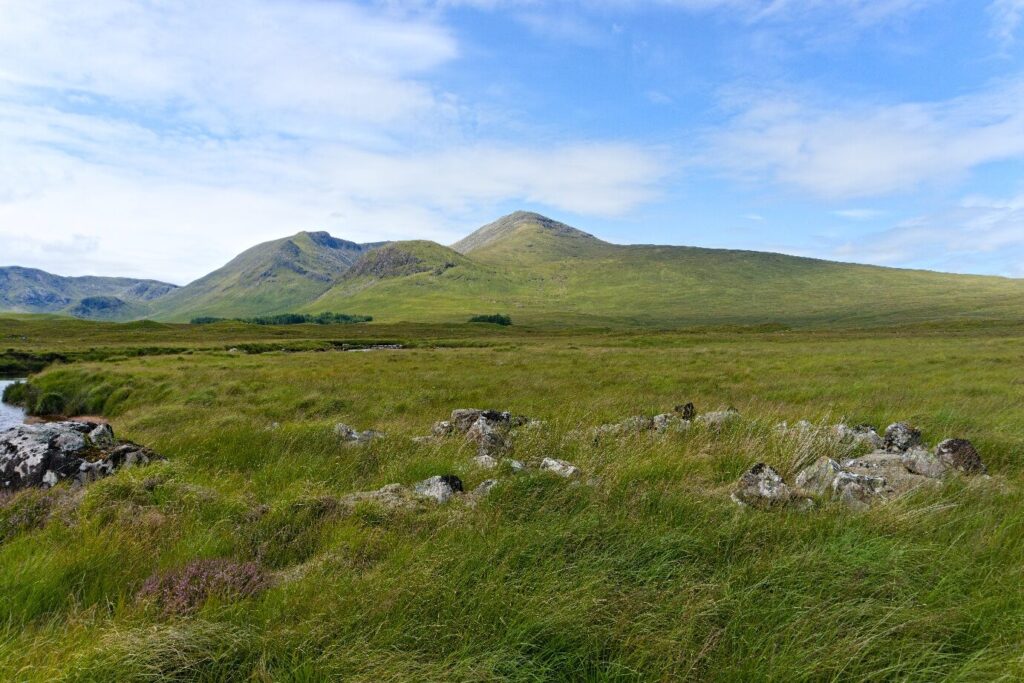
A shieling on the River Ba to the West of the A82 on Rannoch Moor. Photo © Dr Cole Juckette
Once you look closer out on the moor, past the brilliant blue of the myriad lochs and lochans reflecting the sky, and the sublimity of the fading horizon lines of purple heather strewn hillocks to the East, evidence for human activity is everywhere. From 19th century foresters’ cottages, 18th and 17th century shielings and townships, and 14th – 12th century iron bloomery mounds, to prehistoric stone tools. This is a busy land shaped and reshaped by human communities over the thousands of years since the last Ice Age.
You can find out more about this survey project and future plans here: Into the Wild? Rannoch Moor Archaeology Project – Glencoe Landscape Archaeology & Storytelling Project
By Dr Edward Stewart
CVARF Engagement Officer, Archaeology Scotland