Excavating at Drumadoon: A view from the test pits
“I think I found some pitchstone!” calls a hopeful voice from across the field. I jump ungracefully out of the 1mx1m pit I have been working in and walk over. By the time I reach her, this student’s confidence has failed: “Or it might be just a rock”. The small pebble sized stone she hands me is an almost black colour, with a tinge of green to blue depending on the light, and where there are small imperfections in its surface the stone beneath shines as you push soil away. “No, this is pitchstone”. Suddenly more finds are produced, “And what about this bit?” This is another piece of pitchstone but a different shape. It has a clear edge and when you look closely there are small ripples in the surface, a clue to how it has been retouched by a tool, and a sign that this has been shaped by human hands. I hand it back, “Let’s get a finds bag for this one!”.
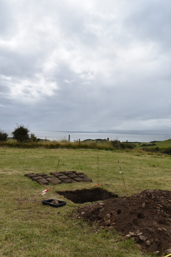
In this week’s blog, I will be reflecting on a week on the island back in August. My main role this week is to assist the field school at Drumadoon, Isle of Arran run by the University of Glasgow and Birkbeck, University of London, alongside Archaeology Scotland, but the opportunity to explore some of the early Neolithic monuments of Arran was too good to miss. Students from Glasgow were excavating a series of test pits in two fields on the Drumadoon estate, hoping to add to our understanding of the archaeological landscape of the area. Test pits are a fast and fairly straightforward way of exploring the potential for archaeology in an area. They also give the students the freedom to learn and try out a variety of excavation and recording techniques, and see the process of an excavation in miniature from beginning to end. We begin with de-turfing, taking care to cut and place squares neatly so we can put them back where they came from in a few days’ time. Then we begin to work our way down through the earth, trowelling back the soil carefully but quickly to move through the layers disturbed by modern ploughing to those that were laid down during prehistory. The next day, I am showing a pair of students how to record their completed test pit. We discuss the importance of capturing information about what we have done, and what we have found, and how making these records can allow this information to be shared more widely
The Isle of Arran is often described as Scotland in miniature. It combined the scenery of both the Highlands and Islands, with the drama of the mountain peaks in the north of the island giving way to rolling fields and coastline further south. The geology of the island is incredibly varied, with almost a third of Arran designated as a Site of Special Scientific Interest for geology, while Arran Geopark was designated a UNESCO Global Geopark in April 2025. UNESCO Global Geoparks are recognised for their commitment to exploring, developing and celebrating the links between geological heritage and broader natural and cultural heritage. Millions of years of history are captured within the bedrock of Arran, famously including fossilised dinosaur footprints from the Triassic period at both Blackwaterfoot and Kildonan. The archaeology of the island is also incredibly rich. Down in Drumadoon, the students are working in the shadow of The Doon, an Iron Age hillfort, as well as the Neolithic cursus which had been the focus of previous year’s projects. Only a few miles to the North is Machrie Moor, a prehistoric landscape featuring stone circles, standing stones, hut circles, burial cairns and cists. The pitchstone they are finding from the test pits is also distinctive. Pitchstone type of volcanic rock, naturally occurring on the Isle of Arran, but tools made from it are found across UK in the Neolithic and Bronze Age. Pitchstone debitage was found at the Ness of Brodgar, Orkney, suggesting that the material had been transported and then worked at the site. Discoveries like this provide clues as to the Island’s importance in this period as well as the extent of possible connections and trade networks.
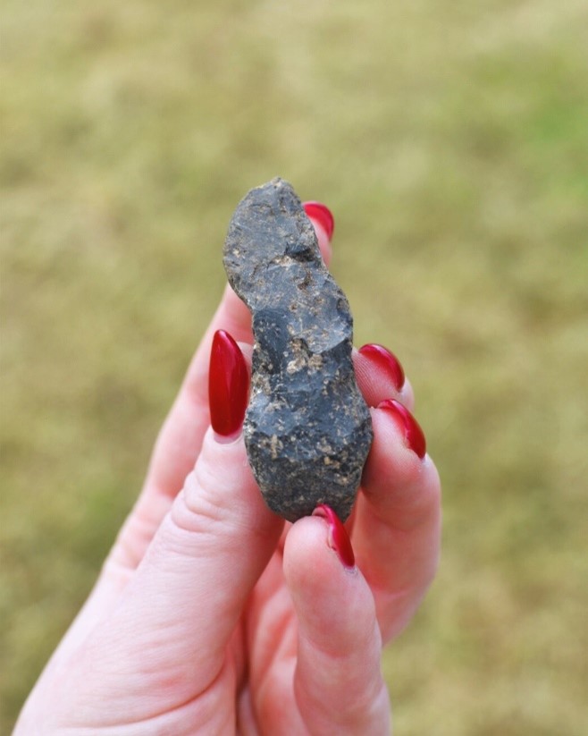
Arran Pitchstone (Isabella Scott)
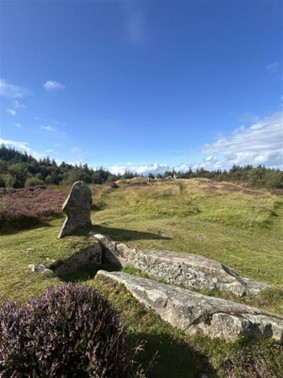
Audrey Henshall visited the Isle of Arran to conduct surveys of the Neolithic chambered tombs on the island over the course of around 10 days in May 1962. In this time she recorded 21 sites. On our day off, Archaeology Scotland director Gavin MacGregor and I headed out to visit Giants’ Graves, one of the most famous Neolithic sites on the island. Giants’ Graves is a complex of at least two chambered cairns, recorded as ARN11 (North) and ARN19 (South) by Henshall. It is a fair walk up the hill from where we parked up, but the path underfoot is well maintained and we make good progress. We can hear but not see the nearby waterfall and the sun is making us wish we’d left behind the raincoats we’d needed only an hour earlier. It can be hard to get a sense of the scale of a monument from pictures and plans alone. I’ve seen multiple pictures of Giants’ Graves before and had poured over Henshall’s plans before setting foot on the island, but as I wait for it to come into view I have no mental image of the size of the site. As I spot the stones, I am amazed at the size and stability of what remains here. The only other Neolithic tombs I have seen preserved like this before have been on Isle of Man, although there are equally impressive examples in Scotland. The façade, entrance and the chambers are still visible and it is far easier to imagine how the site may have been used. With a mound covering these upright stones, as it would have 5,000 years ago, the site must have been an imposing and impressive structure in this landscape.
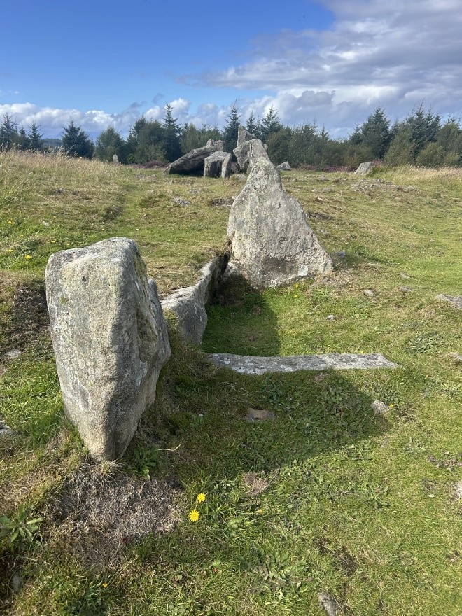
Giants Graves North (1)
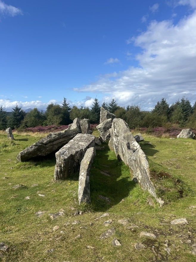
Giants Graves North. (2)
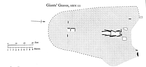
Henshall’s plan of the monument (1972, 383)
Giants Graves South (ARN19). Photo taken from the south of the site
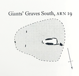
Henshall’s plan of the site, with a star marking the approximate position the left hand photo was taken from (after Henshall 1972, 395)
The surrounding forest now hides much of the landscape from view, but the mountains and Holy Isle to the North may have been visible from the site during the Neolithic. Gavin tells me that this view has changed dramatically in the decades that he has been visiting Arran. I look out at the trees and can’t imagine the view without them. It reminds me of how long people have been changing landscapes across Scotland, from Neolithic tree clearances to modern forestry planting, and how this has not been a linear process. These changes will continue into the future. Rewilding initiatives, such as that at Drumadoon, will continue to re-shape the landscapes around us, not as part of a radical backtracking to an “unspoiled” past, but as steps towards a future with healthier ecosystems and an appreciation of biodiversity and ways of managing the land that make space for nature.
A couple of days later, I make the most of the light summer evenings and head to Machrie Moor. Most of the time it takes me to get there is taken up by negotiating an uneven farm track and once I reach Blackwaterfoot the journey is plain sailing. It is around 6pm but the only other car in the parking area leaves as I am changing into my boots. It is around a 5 kilometre walk across the site, but this walk includes six stone circles! They range in size, type of stone and the arrangement of the stones, as well as in how well they are preserved. Perhaps the most iconic is Stone Circle 2, where the three tall upright stones make a striking image as they stand tall overlooking the moor, but surrounded themselves by the hills and, on the day I visited, the clouds too. The stones are just as stunning up close, and with the site to myself I spend longer than I otherwise would just looking at the textures of their surface, and taking the time to indulge in how small I feel looking up at them from up close. It is irresistible to touch the stones, a tactile connection with the past that you just can’t get from visiting a museum or looking at pictures online. It’s the knowledge that generations upon generations of people have stood here and done the same thing, while history unfurled around them. While this place has changed, and the stones have weathered and in some cases been reshaped, graffitied or moved, you have still stood in the same place as the people that originally set them into the ground. The monuments likely date to the Late Neolithic to Early Bronze Age, making them around 4000 years old, but at least two were preceded by earlier timber circles. Even these earlier constructions, however, were likely later additions to the landscape than many of the chambered tombs across the island. I wonder why it is that these stone circles have come to be the image of Prehistoric Arran for so many people, out of all the possible sites that would have become so famous.
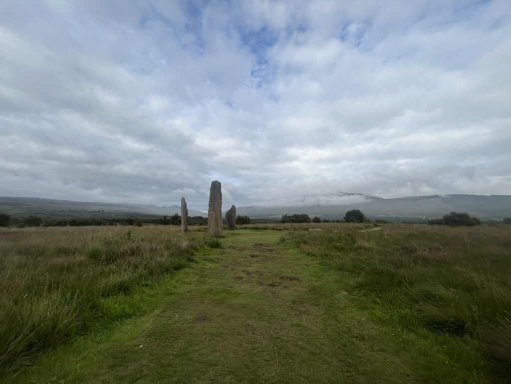
Machrie Moor Stone Circle 2
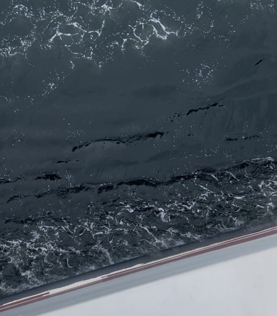
My time to head home comes around quickly, and soon I am back in Brodick waiting for the ferry. I park up then walk along the seafront, picking up a coffee and browsing different fridge magnets for one to take home for my partner, noting how many are adorned with the standing stones of Machrie Moor but how none show Giant’s Graves. I look down to where the ferry is breaking through the swell. Down in the shadow of the boat the water is a deep glassy black. Maybe it is from the week spent combing the soils for it, but I see the ripples and lines of struck pieces of pitch stone. The lines of shaped stone and the curved currents of retouched edges. In the Neolithic, I imagine people leaving the island with full pockets, precious material to use, trade or gift on the mainland. Stone that has its home in Arran and a physical connection to this place. I’m quickly snapped out of my thoughts about Neolithic crossings from Arran by the noise of a large group of seabirds and sure enough, a fin emerges from the water. A pod of common dolphins emerge and cross underneath the boat, a final bit of magic from Arran.
Supported by the Society of Antiquaries of Scotland’s Audrey Henshall Legacy Award.
For more information: https://www.drumadoon.scot/